

amb06
Shooting
Amble Links Rifle Range
55.327292, -1.558611
Amble
Opened:
19th c
Closed:
c1930s
Reclaimed
Condition:
Home Teams/Clubs:
Last Updated:
18 Feb 2025
Amble Rifle Club
HER Description
A rifle range is illustrated on Amble Links in the 1890s. It was 450 yards in length in the 1890s and up to 600 in the 1920s. The target led in a south easterly direction with a flagstaff and a mantlet preventing any stray bullets going astray.
The range was operated by Amble Rifle Club, with various competitions reported on in the local newspapers held at "the Links". One such was in September 1930, with the conditions "two sighters and seven counters".
Events were held here until at least 1937, on the eve of wartime. In the October the last round of the Thompson Cup was held here with six shoots at 200, 500 and 600 yards. The winner was a W Farr with a score of 602
Due to erosion, much of the range site has been destroyed.

Ordnance Survey, 1897
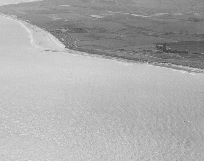
The Amble Links in 1947, around 10 years after the last meet. Hauxley Colliery stands behind the coastline. Source: © Historic England. Aerofilms Collection EAW006060 flown 21 May 1947
Have we missed something, made a mistake, or have something to add? Contact us

Historic Environment Records
Durham/Northumberland: Keys to the Past
Tyne and Wear: Sitelines
HER information as described above is reproduced under the basis the resource is free of charge for education use. It is not altered unless there are grammatical errors.

Historic Maps provided by