Whickham, Gateshead
Whickham Mill
Last Updated:
7 Sept 2023
Whickham, Gateshead
This is a
Mill
54.943900, -1.673493
Founded in
Current status is
Extant
Designer (if known):

Grade II Listed
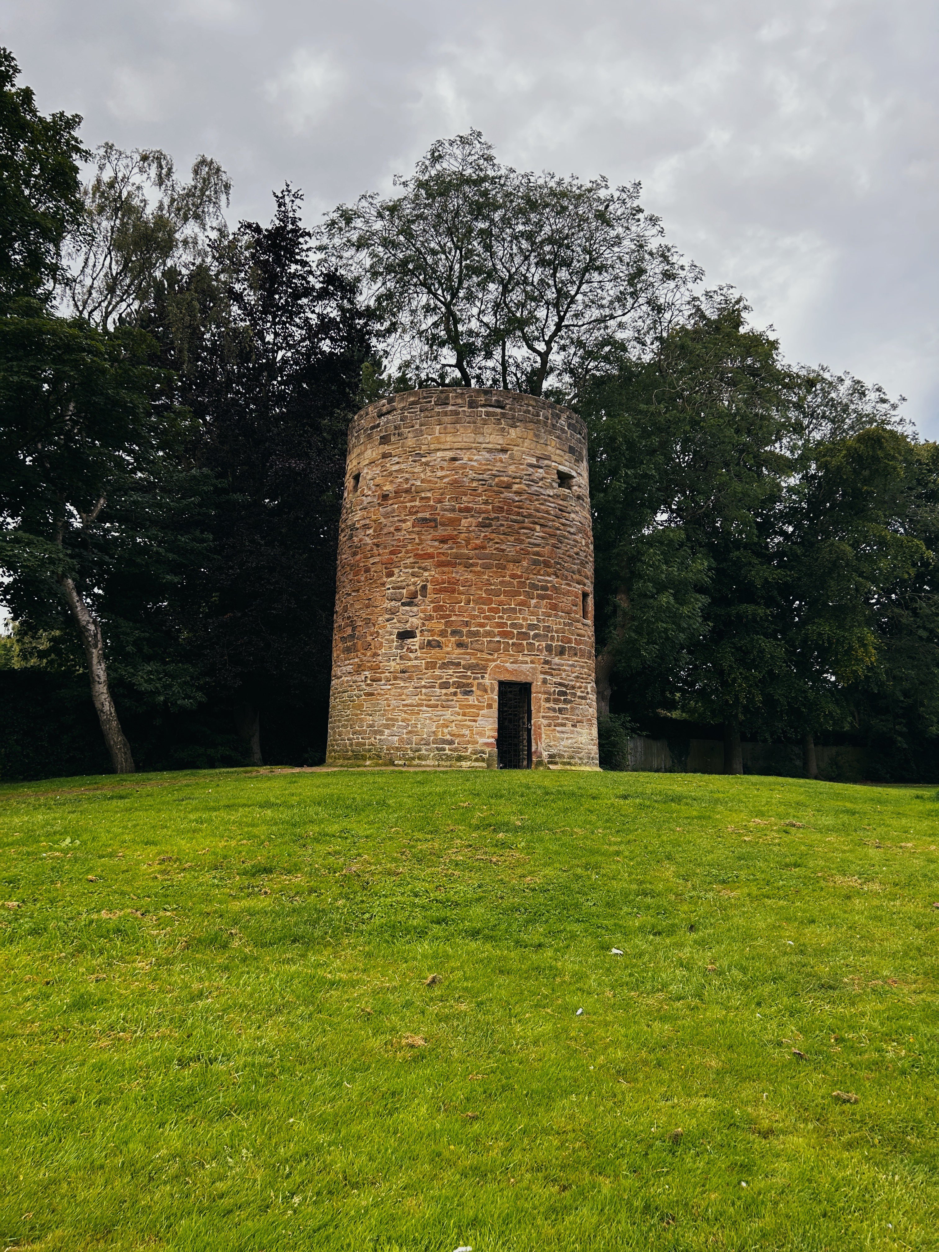
Whickham Mill is an interesting one. It sits in Chase Park, originally a King George’s Field, and much of it may date all the way back to 1720. 1567 is inscribed above the doorway, implying the stone may come from an earlier windmill or was extracted from that iteration.
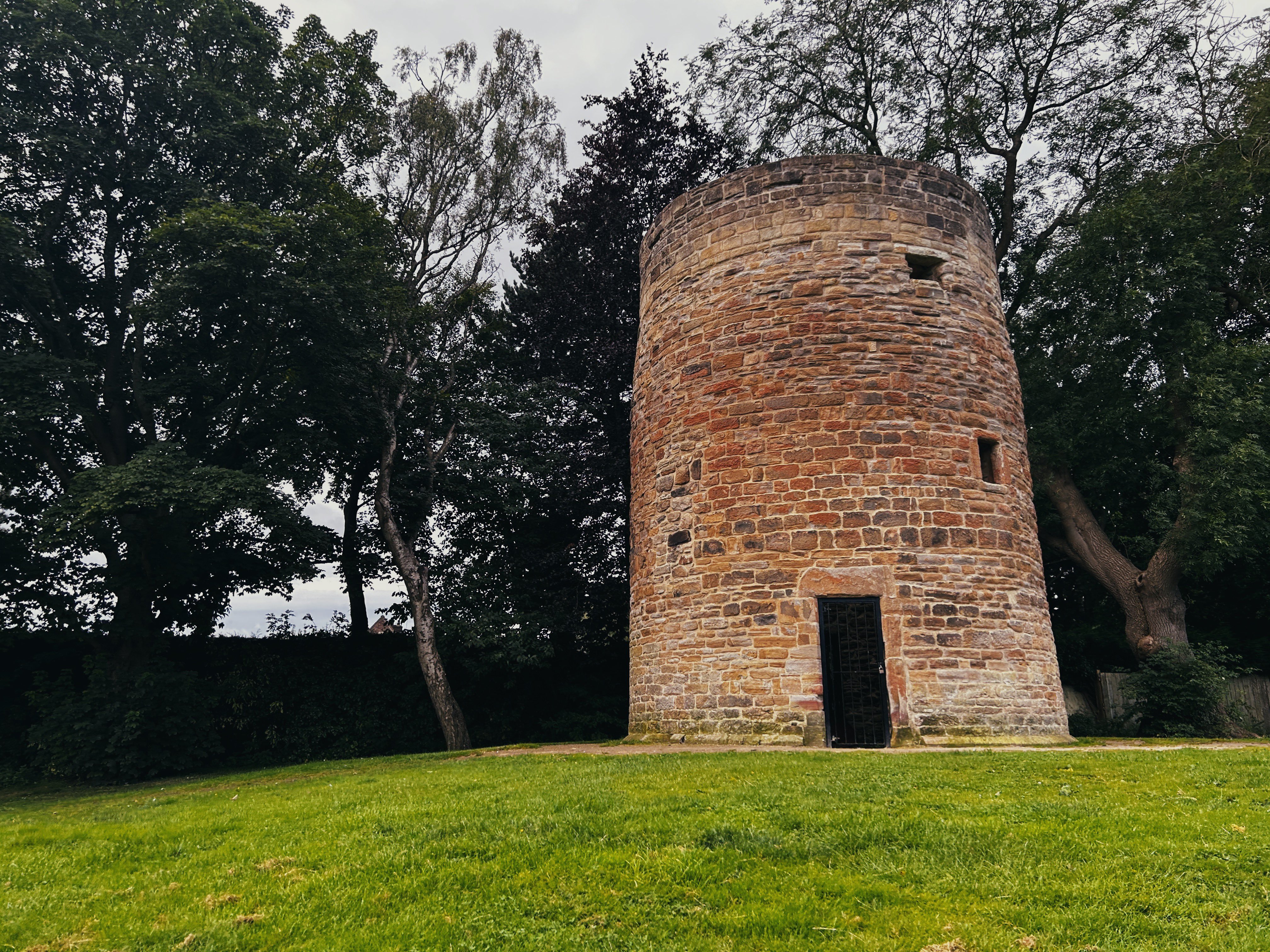
It produced corn, and was once surrounded by a complex of buildings including a cottage, drying kiln and possibly a stable though all of these had disappeared by the 1850s. There’s still a couple of signs of its operating days including bolt holes and sockets for the old beams which held up the floors and platforms.
The Ordnance Survey maps of the 19th century indicate this was in ruins by the 1890s, with only an indiscriminate shell shown. Steam engines likely rendered this old industry time consuming and costly.
There’s clearly been plenty of renovation, and now sits on a bed of colliery waste which provides a nice vista from the bottom of the park. The mound is around 5ft from the original ground level.
The local records also state that when the Scots invaded the area in 1640, they destroyed the millstones and were broken and buried to prevent local food production. This would’ve been the mill which made use of the inscribed stone above the doorway if it’s true.
Listing Description (if available)


The maps above illustrate the site of the windmill and wider Whickham from the 1850s to the 1890s. To be frank, central Whickham has changed little in the past 160 years. Many of the same buildings are retained such as St Mary's Church, the terraces to the west of the village and Dunston West Farm. Some buildings have sadly been lost though, such as Whickham House and Whickham Hall.
The Mill appears to still be in operation at this time, with the round structure the one we're referencing and another ancillary building directly south. There is also a pond about 50m west which may have been used during production.
The 1890s map presents a similar vista, though the windmill is not even annotated. It is simply a hollowed out structure on this map, implying it is ruined or abandoned. Whickham had densified and expanded in the west with part of Fellside Road filled with terraces and chapels, in part thanks to the opening of Whickhambanks Colliery. Many of the old field boundaries from this time can still be seen today in the garden boundaries and streets.

The 1919 Ordnance Survey map shows the pond in situ alongside the windmill and small structure to the south. The windmill is clearly ruined and abandoned by this time, as it has been overwhelmed with a small wooded area fenced off from the wider area. It was in the late 1930s when this area was brought into public use by the local urban district council and after this point was renovated.
Great expansion can be seen in the area westwards.

The corn mill in 2023

A closer shot of the mill in 2023. It appears there was a window of something similar on the left, which has since been filled in with stone.

The windmill can be seen in the small wodded area in the centre of this shot from 1945. Source: Historic England Archive (RAF photography) Historic England Photograph: raf_106g_uk_1051_v_5044 flown 03/12/1945
