Prudhoe, Northumberland
The Spetchells
Last Updated:
2 May 2023
Prudhoe, Northumberland
This is a
Industrial site
54.971176825762925, -1.8520205715861717
Founded in
Current status is
Preserved
Designer (if known):

Now a nature reserve
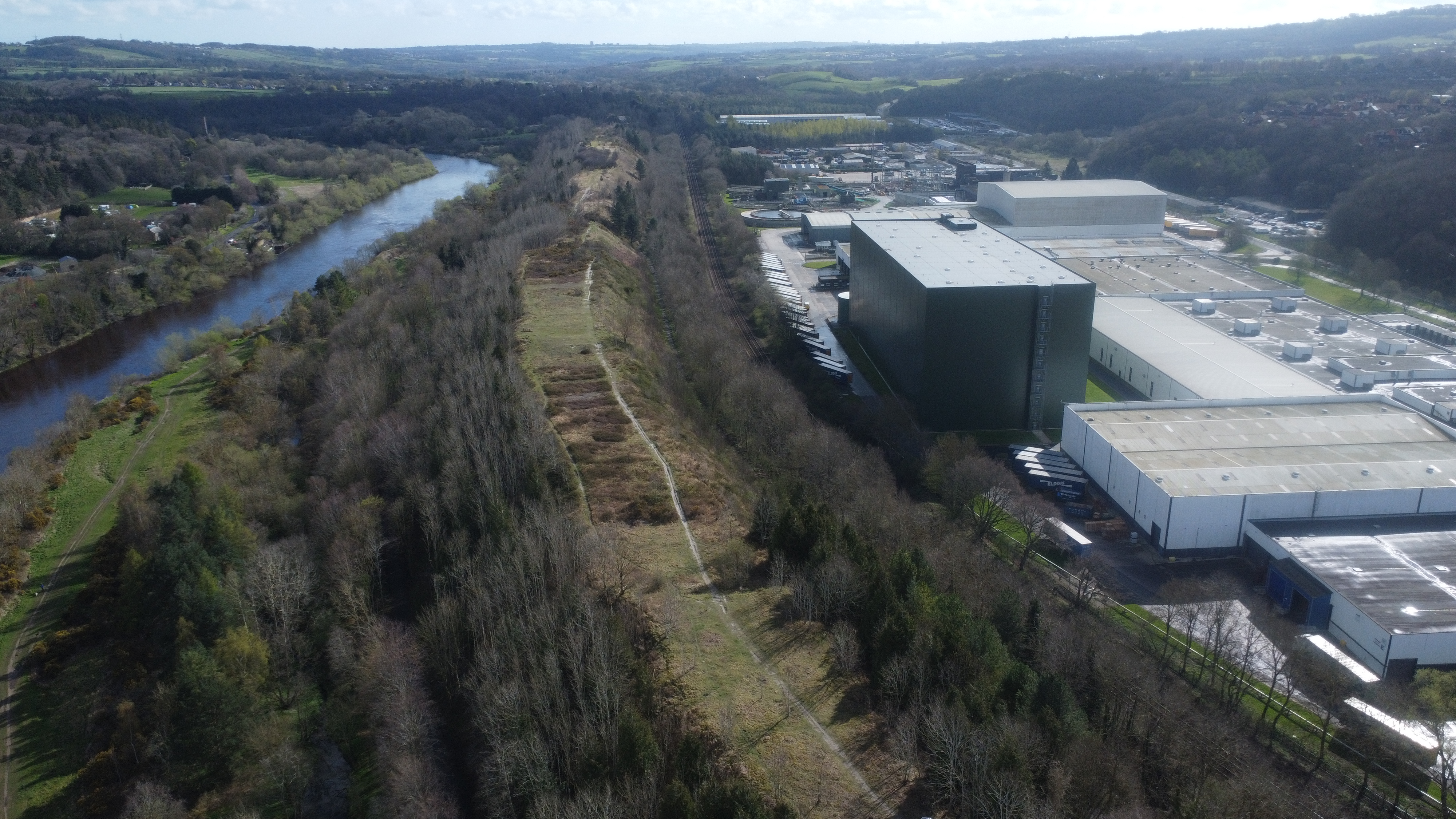
The Spetchells is a great corridor of chalk nr Prudhoe. It is one of the region's largest and most visible legacies of World War Two.
It is entirely man made, having been created from the chalky waste product from ICI. ICI Was a chemical company who took over the land where Prudhoe Castle Farm was located. The ICI complex started construction in 1941 and the sulphate plant was fully operational by 1942. It provided employment for nearly a thousand people.
The chalk, calcium carbonate, was a waste product from manufacturing ammonium sulphate for fertiler and explosives during WWII.
As the waste built, it essentially formed a heap similar to what you would find at coal mines. It was tipped to form long narrow hills along the riverside on an area of land known as "The Spetchells". It's estimated the tips weigh around 2 1/2 million tons, though some was moved in between 1949 and 1964 by Bill Thompson (of Thompson's of Prudhoe). Trees were planed to stabilise the mounds, with the tops also being turfed to conceal them from German bombers overhead.
The ICI plant started to close in 1965 and was completed in 1967. Some of the employees were transferred to a facility at Teesside. A paper mill was developed in its place and is said to have been the most modern in Europe.
The site is now a nature reserve, and is Northumberland's largest chalk grassland habitat.
Listing Description (if available)


The two maps above illustrate the Spetchells area in the 1960s, and the area pre-dating the ICI factory in the 1890s. The first, from 1966, shows evidently the huge ICI complex and Spetchells directly north of the Newcastle to Carlisle line. A subway allowed access under the tips from one side of the chalk to the other. Interestingly, the West Wylam Colliery was linked directly to ICI by rail also.
I have attached an earlier map also to give an impression of the site pre-ICI. It is from the 1890s, and shows the farmland operated by Castle Farm which stood in the shadow of the castle on the hilltop. Much of the land was owned by the Duke of Northumberland , who sold the area to ICI. The last tenant of the farm was a Thomas Frederick Johnson, and a photograph of the farm can be seen here - https://www.prudhoelocalhistory.com/industrial-expansion.html#:~:text=The%20ICI%20factory%20was%20built,the%206th%20Duke%20of%20Northumberland.

The chalk corridor can be seen clearly on this aerial shot facing east. The area was already known as the Spetchells.

The side of the cliffs clearly show the chalk where parts of the land have fallen.

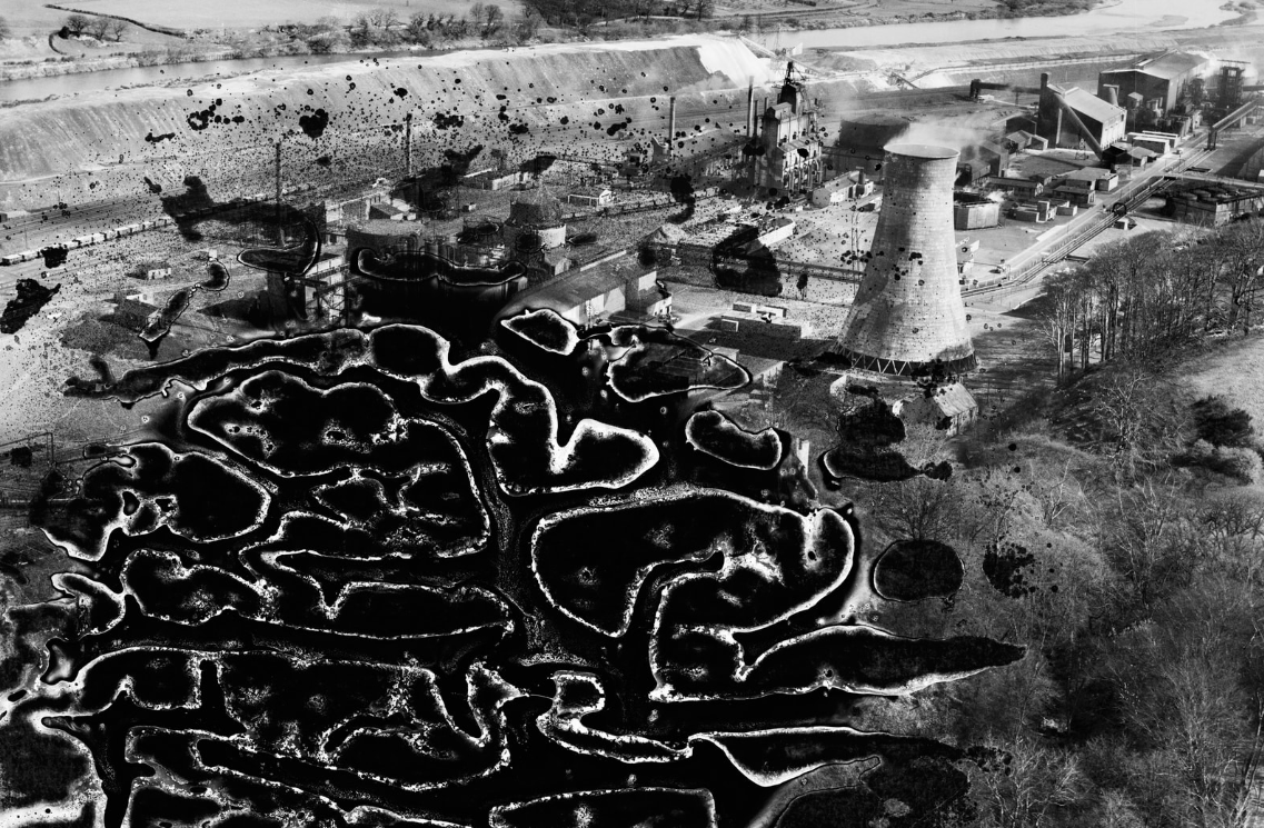
The Spetchells can be seen on the top of this damaged negative from 1948. Source: The Imperial Chemical Industries (ICI) Chemical Works, Prudhoe, 1948. This image has been produced from a damaged negative. © Historic England. Aerofilms Collection Historic England Photograph: EAW014546 flown 15/04/1948
