

Chilton Moor
The Chilton, Black Boy Road
Last Updated:
6 Feb 2025
Chilton Moor
This is a
Dwelling, Pub
54.836798, -1.508799
Founded in
Current status is
Ruined
Designer (if known):

Subject to arson attack in 2022
Bit of a heartbreaker this one as we lead onto the road into Great Lumley. This is The Chilton, a country pub burnt to a crisp in the past few years.
It’s been through an eventful life, this place. I can’t tell you its origins, but I think it’s likely to have been a pit row for a nearby pit which closed by the 1850s. About 100m west of Morton Acres, which I imagine was one of the Lumley pits in the early 1800s.
My thinking comes from the fact that this became a public house in the 1850s called the Black Boy - a coinage widely used to represent the sooted faces of young lads upon leaving the pit. Mr. Smurthwaite ran it in the 1850s, but his tenure was very short-lived, disappearing from records in the 1860s. It’s notable that the bridge over the Leamside Line just east was also called the Black Boy Bridge.
Thereafter, it appears that at some stage it was repurposed as a pub called the Bonny Pit Lad Inn, but I’ve found it difficult to substantiate this. A piece from the Sunderland Echo in 1962 recalls there was a pit lad effigy above the door, recalling the Black Boy name given to the site. There was also a cockpit here, but no year is given at all for when this was.
Certainly by the 1890s, they were called the Black Boy Cottages, so I can be certain they became domestic dwellings once more.
I’m surprised by how new this pub is, opening in the 1980s and adding the rendered hotel on the right-hand side. The arson attack took place in 2022, twice, in June and September. The first took five hours for firefighters to temper the flames to safety. The second left it in this ruinous state. The historic row will probably never see the light of day again.
Listing Description (if available)


These Ordnance Surveys illustrate Black Boy Road and the cottages from the 1850s (when the map was surveyed) through to the 1890s. You'll notice on the first that it was in operation as a pub, probably utilising at least 1 of the 3 cottages which stood here alongside the end cottage which we still see today. It was likely used by passers by and local farmhands and those working over at the Eighth Pit & the railway alongside. Still though, it's quite rural and I can't imagine they did a roaring trade.
It was converted back into 3 (or 4) cottages by the 1890s, and we can see the partition on the later map. I do wonder why the most southerly cottage was offset against the rest on the roadside.

The Ordnance Survey of 1920 shows the cottages little changed. The Back Lane still remains leadin to High Dubmire, though the road is blocked by the fencing securing The Chilton.

The razed Chilton in January 2025
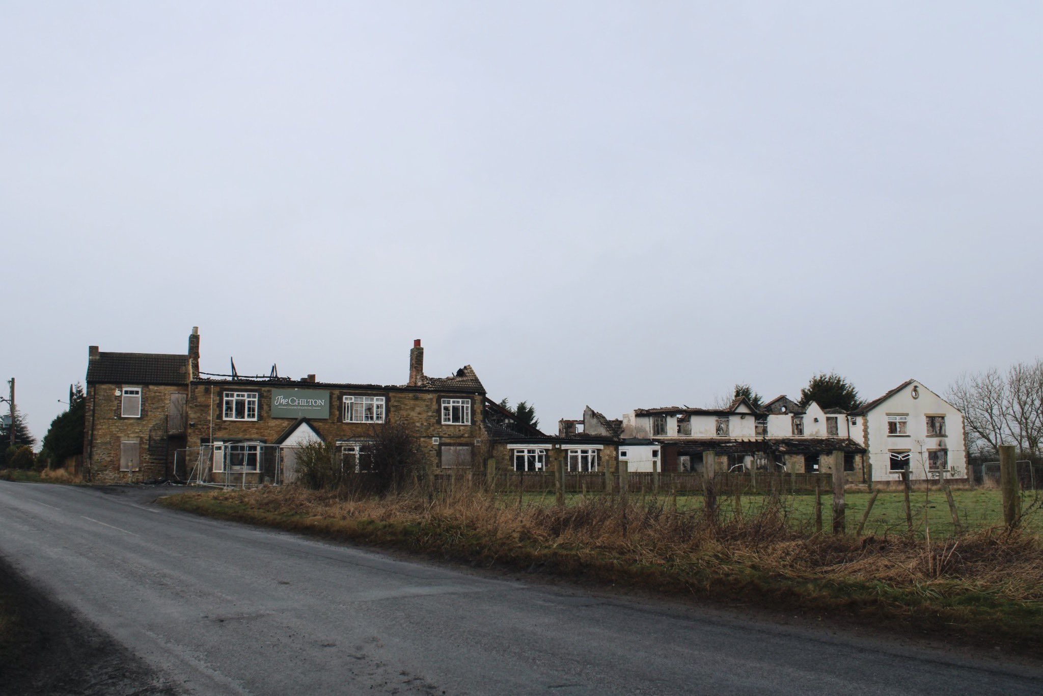
A full perspective of the end cottage, the row of 3 and the later hotel from the 70s or 80s. The full complex was burnt down in two separate fires in 2022.
