Gateshead
Oakwellgate Coal Drops
Last Updated:
4 Sept 2023
Gateshead
This is a
Coal Drops
54.966997, -1.600790
Founded in
Current status is
Extant
Designer (if known):

Listed Grade II
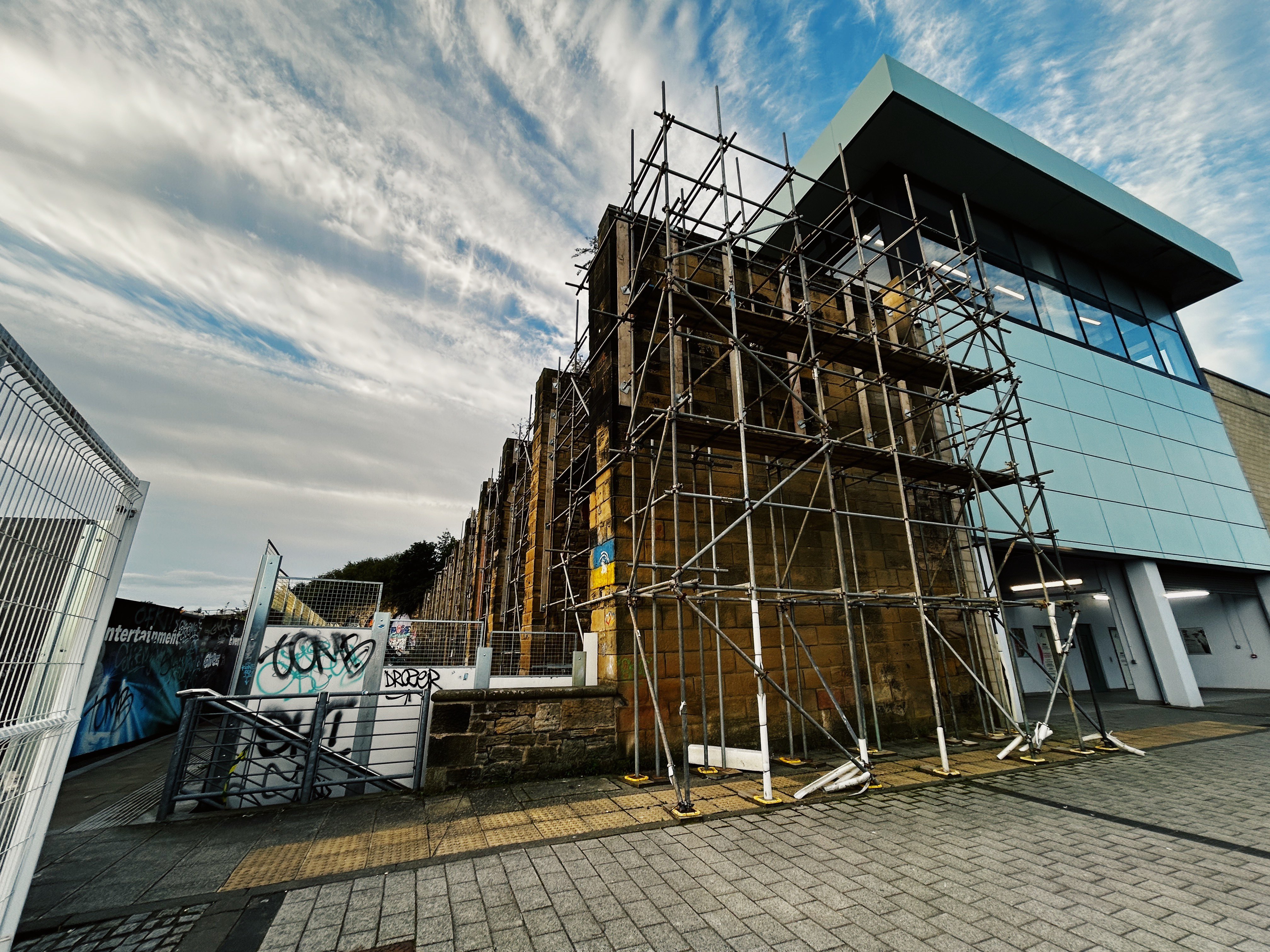
These stone walls adjoin the car park opposite the Sage. In actual fact, this whole structure was one of Gateshead first railway stations - Oakwellgate.
These are coal drops, constructed in 1840 by the Brandling Railway. Coal would be tipped through chutes in between the stone and landed in awaiting wagons below. The coal would then be transported down to the “Cinder Quay” next to where the Millenium Bridge is located. It's likely the coal was also used as the gas works, which was situated at the sage. Coal was burned to produce the gas to store in the holders for wider industrial use.
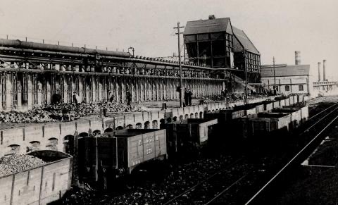
The Cinder Quay was owned by Marley Hill Colliery, and consisted of a whole row of coke ovens fed by the coal from the drops. It was then heated up to produce coke for metal working and so on. There are sadly no remains at all of the Cinder Quay, but would have been a real site as there was an overhead railway which led from this site and fed materials to the coal ovens. They closed sometime before the 1890s.
They were also attached to the old Oakwellgate Station, which was the terminus of the railway to Monkwearmouth and South Shields. There were other stations at Redheugh and Greenesfield, where the MPD was later located.
These drops are the last remains of a whole supply chain on the Quayside. They are grade II listed, so thankfully aren’t at risk despite ongoing redevelopment but may be going through preservation works or repair.
Listing Description (if available)


Both maps above illustrate the immediate area between the 1850s and 1910s. This area of Gateshead was already densely packed by the 1850s given its location on the main highway from London to Edinburgh. Oakwellgate is one of the oldest streets in Gateshead, and featured the rectory alongside the old gas works, public baths and the gas works.
The railway can be seen on both maps, though you may notice it isn't directly connected to the drops. It appears the coal fed to another building on Maiden's Walk and was possibly transferred to other wagons to take to the overhead railway on South Shore. They may have been specially fitted to deal with the incline.
The course of the incline had also changed through the decades, and by 1919 it had been severed to Hillgate Quay. The course of the line however survived into the 1960s.

The 1947 edition shows the Oakwellgate yard area still in use, predominantly as sidings. The coal drops are still extant and covered, but likely no longer used unless for immediately use in the area. Every railway connection underneath had been lifted though the course to Hillgate Quay can still be seen. Many of the nearby streets were being cleared by this time, potentially due to wartime bombing, slum demolitions and/or advent of the Tyne Bridge. Bottle Bank, Cannon Street and Church Street are included

The coal drops wrapped in scaffolding in 2023

The South Shore coke ovens sometime in the 19th century. A Pontop & Jarrow wagon can be seen in the foreground. Source: Gateshead Libraries

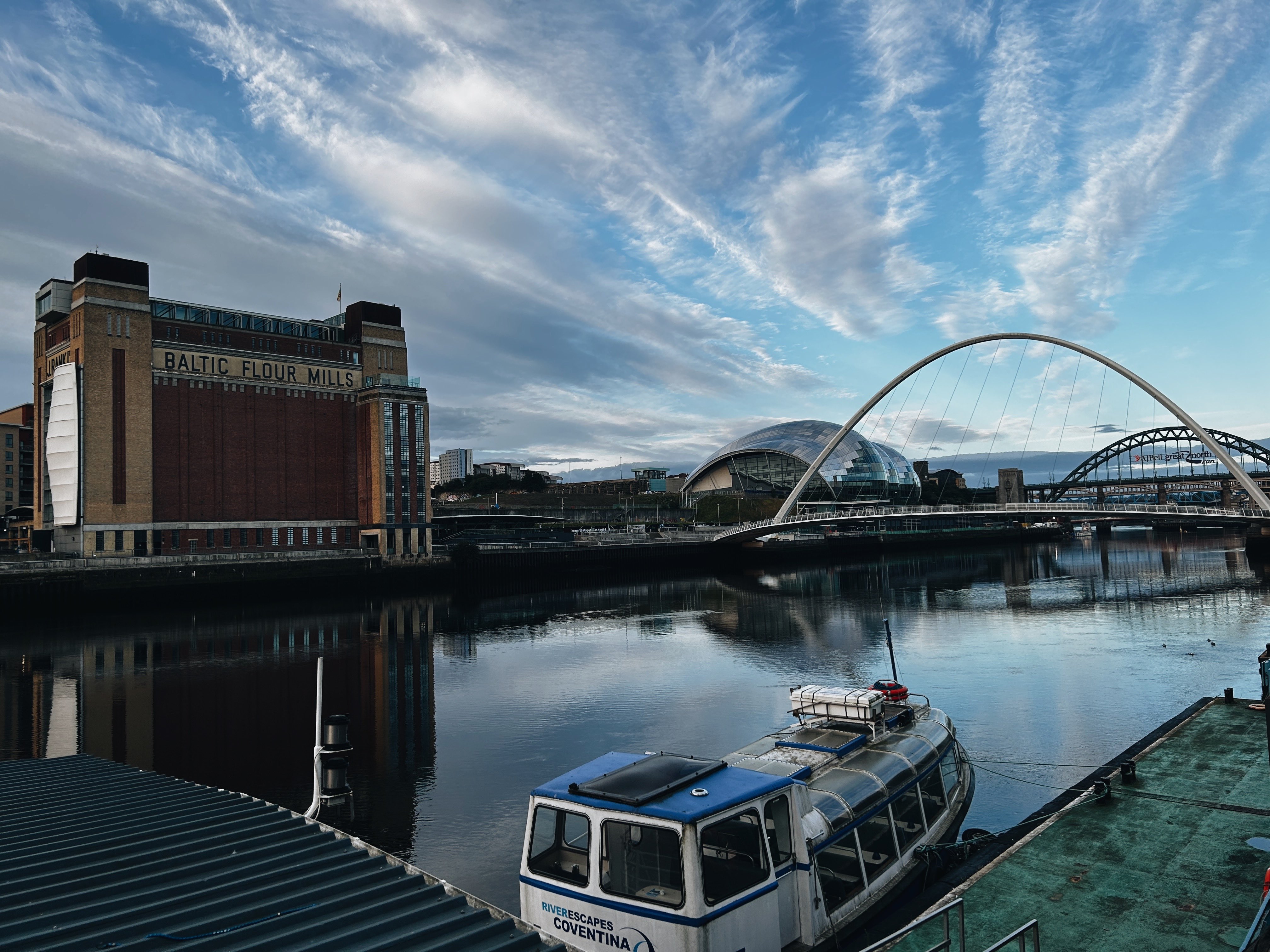
Site of the coal drops and coal works in the Quayside vista, 2023
