
Durham
Durham Viaduct
Last Updated:
20 Dec 2023
Durham
This is a
Viaduct, Bridge
54.778295, -1.583088
Founded in
Current status is
Extant
Designer (if known):
Thomas Harrison
Grade II* Listed
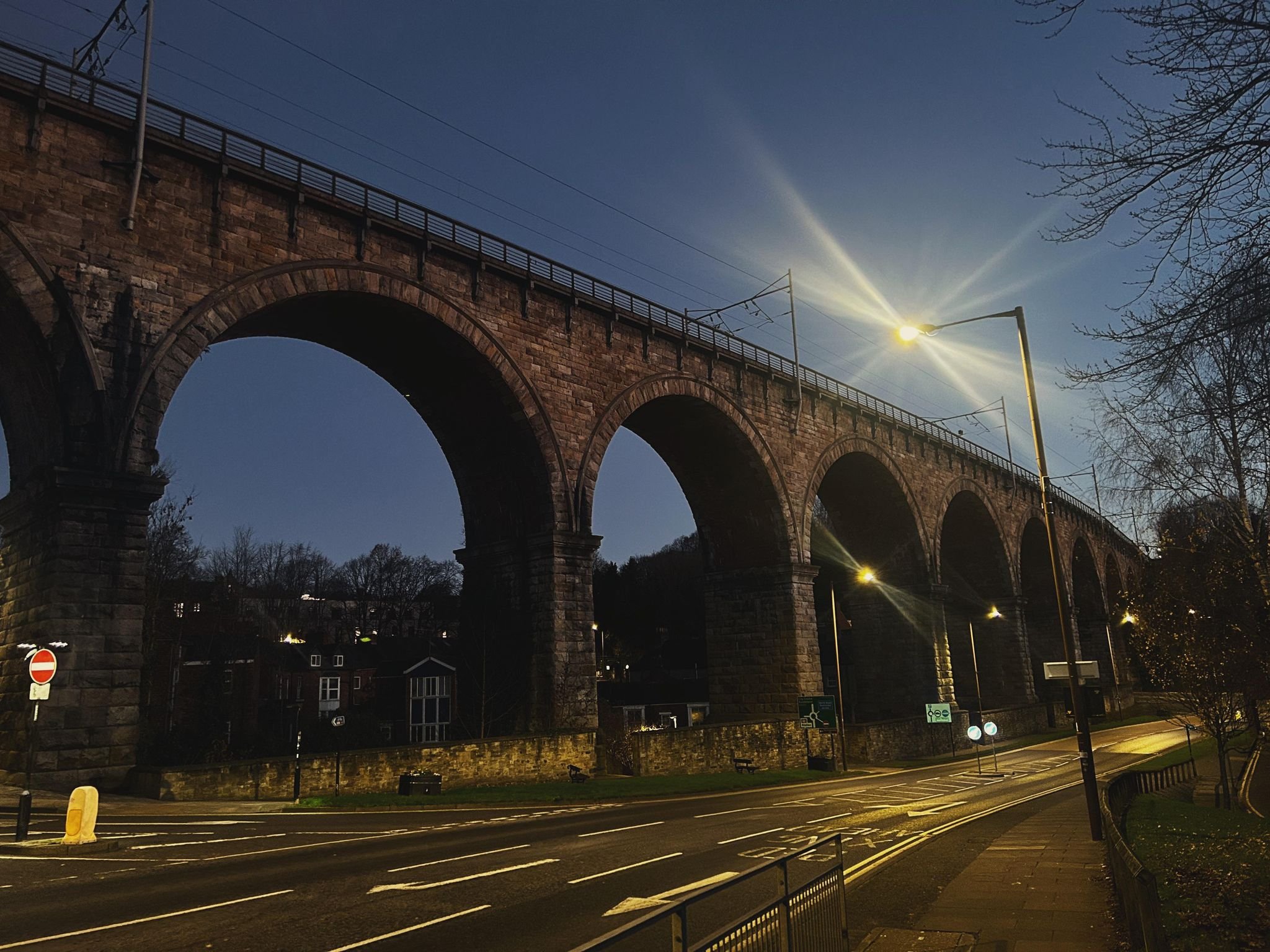
The iconic (and I don't use it lightly) railway viaduct overlooking Durham has been a staple part of the urban landscape for 170 years.
The crossing was constructed in the 1850 to a design by T E Harrison who was responsible for many engineering projects in the North East. The bridge at Brockley Whins and the Wearmouth Bridge are two i've covered, and can be seen on the site also.
The Newcastle Journal of Feb 1855 provides an insight into what the viaduct was expected to be before it was completed. It would consist of "11 arches, 60 ft span, and about 100ft high. From it on the right the traveller will obtain a view of the handsome County Hospital, and on the left of the City of Durham...the Cathedral, Castle and river will be exceedingly fine". About half a million cubic feet of earth was removed from the embankment just south also.
As noted by William Robert Rennison in his book "Civil Engineering Heritage: North East England", the structure is composed of masonry with brick soffits to the arches and is built on a curve. Though T E Harrison was the engineer-in-chief, the contractor was Richard Cail who was responsible for similar projects in the region - namely viaducts at Brasside and Newton Cap on the same railway.
It's also worth noting the viaduct was originally built for the Bishop Auckland to Durham Railway, given the mainline ran via Washington instead. The whole railway itself opened around June 1856 and was the most expensive in North East England - around £200,000 in total partly because of projects like this.
The deck was reinforced in 1991 by A Monk & Co Ltd to prepare for overhead wires to be installed for wider electrification on the East Coast Main Line. It doesn't retract from the beauty of Britain's most iconic railway journey.
Listing Description (if available)


Both Ordnance Survey maps above illustrate the viaduct over Durham in the latter half of the 19th century. The first shows the railway station before its use as a principal stop on the East Coast Main Line, and was to be further extended as seen on the map from the 1890s. There were still more platforms today though, providing a terminus for services from West Durham.
The city was also yet to develop much of its western periphery. The terraces were built between the decades shown around Mowbray Street, and expanded at Albert Street. Wharton Park was opened in 1857, but is not labelled at this stage.
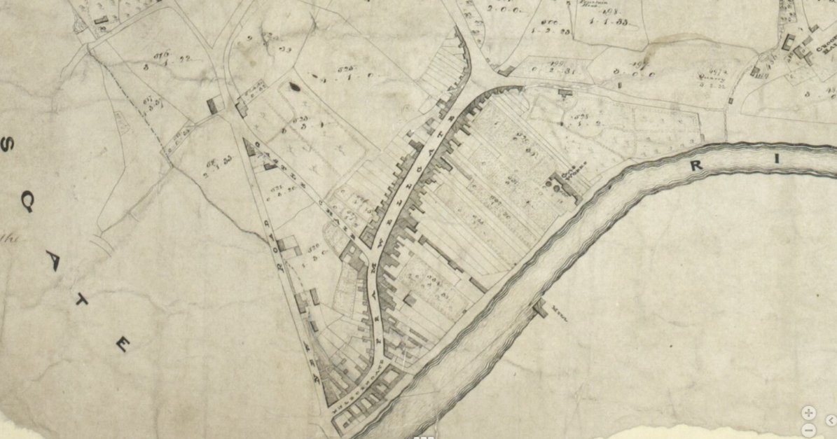
Source: Durham University This third Framwellgate tithe map dates from 1838, held by Durham University. This is a couple of decades prior to the railway opening on the side of Durham, and shows the long winding lane of Framwellgate and the 'New Road' which was to become North Road. The viaduct and station would later be located in the top left of this plan, though at this time it appears to simply be pastures and grazing land.
Durham Viaduct at dawn in 2023.
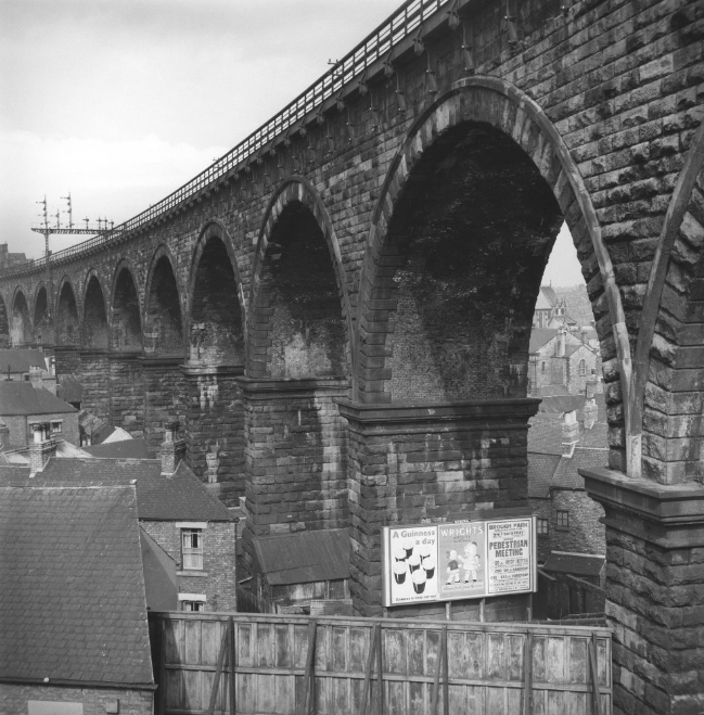
The viaduct photographed by Eric de Mare in 1960. Source: Historic England
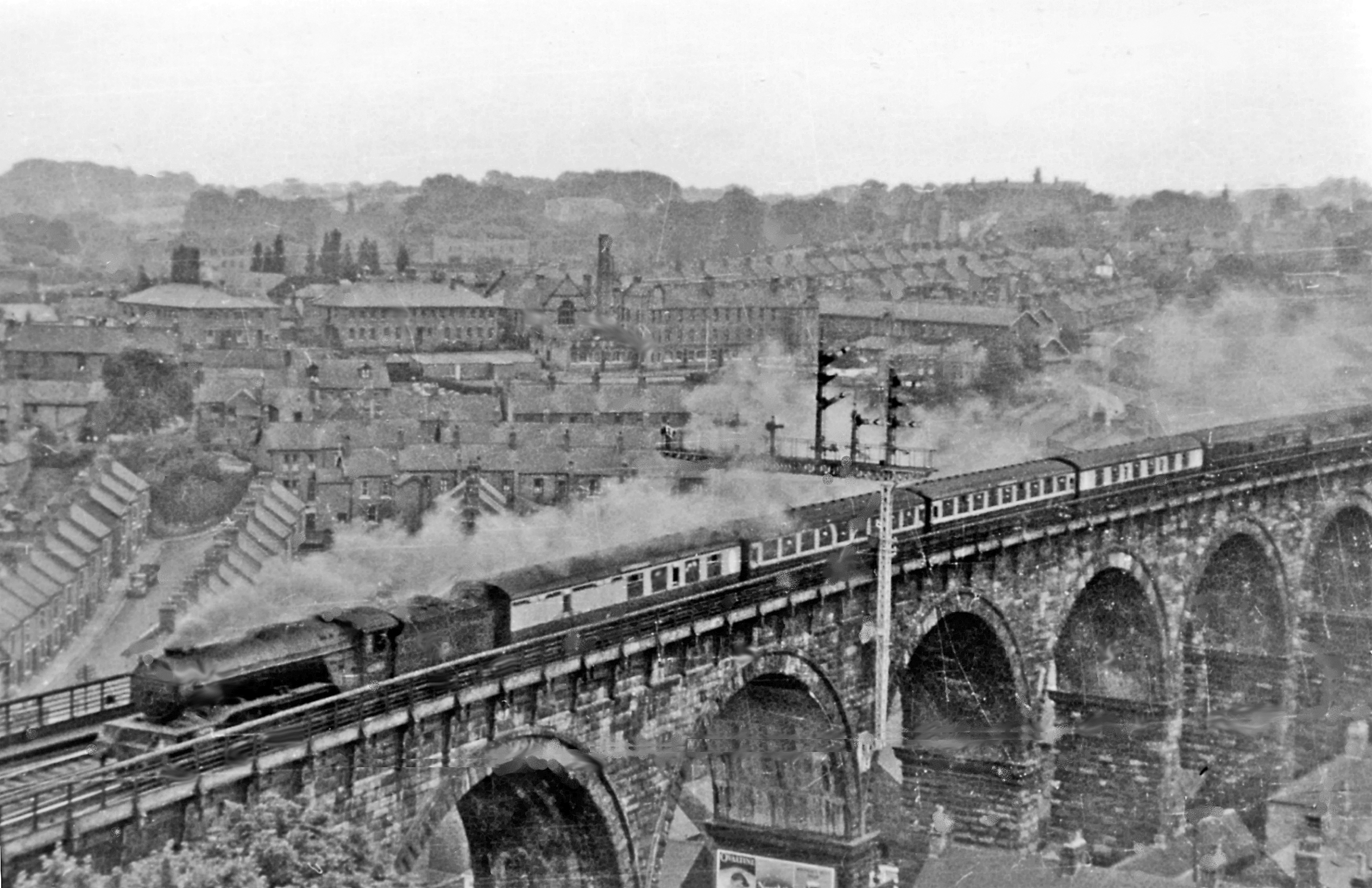
Durham and the viaduct in 1953, with the 9:40 service from Kings Cross to the Tyne Commission Quay featuring. Source: Ben Brooksbank, Geograph