

Dunston, Gateshead
Dunston Railway Station
Last Updated:
22 Jul 2024
Dunston, Gateshead
This is a
Railway Station
54.950000, -1.641400
Founded in
Current status is
Extant
Designer (if known):
Still in use
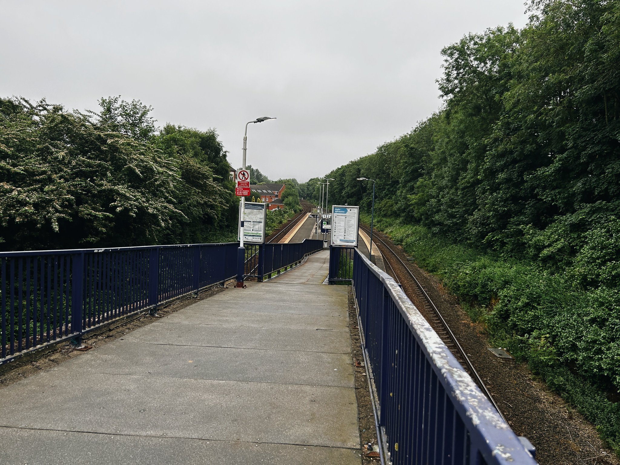
Dunston station is, with regret, a spectre of its former self these days and is one of the most underutilised stations in the region despite fairly dense surroundings. With this in mind, we're lucky to have it again.
There was a station here from 1909, when the North Eastern Railway constructed a line to link the new King Edward VII Bridge with the original Newcastle & Carlisle. This line originally followed the riverside and terminated at Redheugh, which is why there's a Railway Street down the bottom end of Dunston.
Our line provided a useful chord to reach Dunston Staiths from Newcastle as well as the endless industries on the banks of the river. Thanks to them, Dunston grew exponentially at the of the 19th century which made a new station here quite important. It was originally a terminus, providing a regular shuttle up to Central Station. However, this only lasted until 1926 when the station closed for the first time. The main reason was the General Strike and the shortage of staff to serve it. Even during WWI, services ran until 8pm here.
It wasn't until 1984 that services re-commenced. This is due to the misfortune of those living on the north bank of the Tyne and the closure of the Scotswood Bridge. Services had to be diverted via Dunston to Carlisle, and at first Dunston was as regular a stopping point as places like Blaydon and Corbridge. However, due to the lacking passenger numbers it's now not even a secondary station on the line. Currently around 25k people use it annually. Even Cramlington gets 133k.
Listing Description (if available)


Both Ordnance Survey maps shown illustrate the area around Dunston Station between the 1910s and 1940s. Dunston was still growing as a conurbation in the 1910s, with the area south of the station still being developed piece by piece. The station however is already in situ having been open for around 5 years from the point of survey around 1915, catering the industries of Dunston Forge and Low Teams to the east and Ravensworth Road to the south.
The scene is much more familiar in the 1940s map, with the sweeping residential developments between here and Dunston Hill. The station was reopened for occasional evacuation trains and good continued to flow. Dunston Recreation Ground can be seen to the north west featuring two bowling greens, tennis courts and a putting green.

The 1898 Ordnance Survey map was only a decade and a bit before the 1919 map shown above, but there is a huge transition from the pre-railway days. The Dun Cow, labelled "Inn", makes for a helpful reference point for where the railway was situated.
Dunston Railway Station in 2024
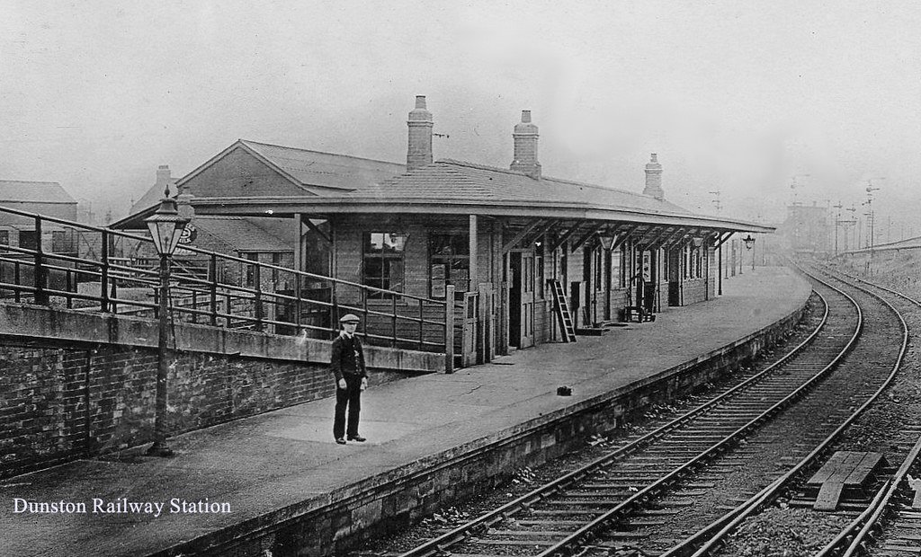
The railway station in the 1920s. Unknown original source.

Dunston Railway Station in the 1910s. You may notice the Steam Autocar in the foreground, as well as the steam crane. Unknown original source.