

Wallsend
Central Buildings, Wallsend
Last Updated:
3 Apr 2025
Wallsend
This is a
Shop, Offices
54.991343, -1.533654
Founded in
Current status is
Extant
Designer (if known):

Locally listed
Wallsend’s main junction between the High Street and Station Road has changed massively in the past century and a half. I’ve covered the Woolies site in 2023, so now for over the road – a plot with a very rich history.
This is a historically important site, given its location on the main lane to the station and the turnpike between Newcastle and Tynemouth. When pit rows stood next door, it was quickly claimed to erect a Methodist Chapel, which is seen in the 2nd shot. It was for the New Connexion congregation, one of the many dizzying Methodist sects which supplanted themselves in pit villages. It was opened in 1857, with the foundation stone laid by Sarah Love, who was endowed with a huge estate of collieries and was a proponent of the New Connexion movement. You might recognise her surname on bricks across Durham. It seated 300 and was a substantial brick construction, far superior to the other Methodist chapels in town at this time.
Its replacement came about in 1904, with services held over the road in the Wallsend Cafe until completion. The Allen Memorial Church on Park Road, a vastly bigger church still in situ today, was opened by the Hunter's.
With the plot becoming vacant, it was an attractive spot for commercial and office premises. Officially named the Central Buildings, the ground floor was advertised for let in 1904 with a Home and Colonial Tea Store neighbouring it. The upstairs appeared to be occupied in the coming years by Fleming Davidson, the architect of the Wallsend & Willington Quay Joint Hospital Board. The street-level premises became a fruit shop, with a banana-ripening room also located inside. Much of this was destroyed by a fire, with a good stock of the bananas ruined by this too.
Some might know it better as Boots, which it had been in the mid-20th century, as seen in the 3rd shot. The polychrome brickwork makes it clearly identifiable. Nowadays, a Ramsdens occupies the lot.
Listing Description (if available)


Both Ordnance Survey maps shown here depict the Central Buildings from the 1910s until the middle of the 20th century. This site took a prime spot in the town, neighbouring cinemas & countless pubs between the main road to Shields and the station. There were some notable changes occurring through these decades, including the construction of the Memorial Hall by the firm of Frank Caws, the man who earlier designed the Wallsend Cafe in the 1880s. The firm also designed the institute on Station Road.

Let's turn back time to the end of the 19th century, where we can still see the Zion chapel in situ. Wallsend through through the 1890s and 1900s was right in the middle of its housebuilding boom, as seen in the Ordnance Surveys from this time period. Given the flank of shipyards and collieries, the "Carville" area was perfectly placed to site thousands of workers and their families. The amenities developed in this time covered every aspect of their lives too - chapels, theatres, public houses and post offices dotted the high street alongside the chapel. This is alongside the lawn tennis ground, which used to stand directly next to the cafe.

The Central Buildings in March 2025
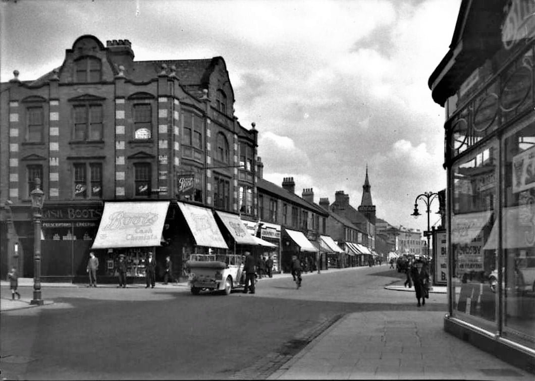
The Central Buildings under the guise of Boots in around the 20s or 30s. Unknown photographer.
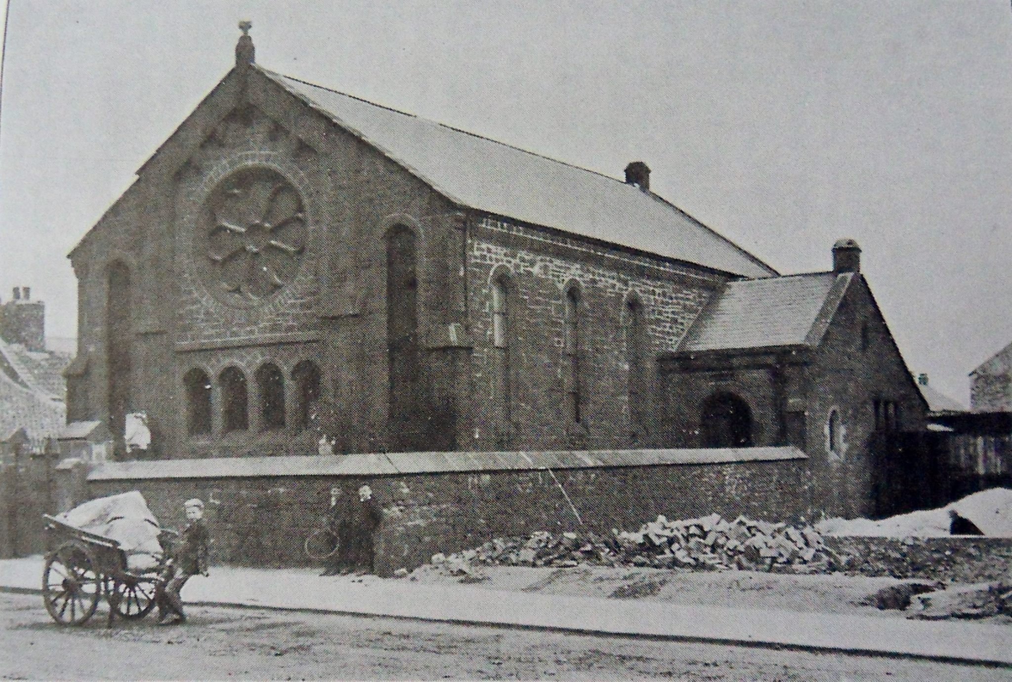
The Zion chapel from the High Street looking north. This stood in the same spot until the early 1900s. Unknown photographer.